Monday, August 12, 2019

And Home to Bisbee

After 3 days in BC, I was ready to start the ride back home. Whether it was exhaustion or homesickness, or just a weariness of all the green, (there's mostly brown in southern Arizona), it was time to head back. I made a brisk trip of it. I stopped in the Cascades of Washington and will need to return there. The beauty of the mountains along Hwy 20 rival the beauty of BC. But as soon as I saw a roadsign that said, "south", I was done. From then on it was mostly 500 or 600 miles days on major roadways. I managed to stay off of I-5, but as I came through Salt Lake City, Utah, it felt like I was on a merry-go-round. I kept trying to get out of Salt Lake, but seemed to always be on the wrong road. At one point, I rode 30 minutes back north, in error of course. Once I was out, I planned the remainder of my route through Utah with greater care. I eventually got through Utah, and into Arizona.

One of the greatest areas of the west, Arizona boast the White Mountains. They range in elevation from 5000 feet in the south, (about 3 hours north of Bisbee), to 11,000 feet toward the central part of the state. I'm making plans for some future road trips to this area. Riding to BC was a courageous adventure, my travel supported by dear friends, but keeping it close to home for a while will be enough for me. Thanks to all who helped and enabled my on this wonderful journey. I am truly blessed with some wonderful friends. :-)

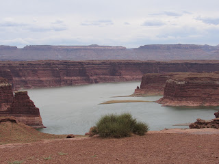
Capital Reef NP, Utah
Chimney Rock, Capital Reef NP

View from Mamquin Forest Road campsite in Squamish, BC 
 Hwy 20, Washington
 And the last campsite...


Monday, August 5, 2019

Port Angeles to Victoria, Vancouver Island

Leaving Port Angeles, the spirit of adventure has returned. I was getting pretty comfortable and settling into a little routine while I was there. But this trip is about adventure, and I'm rolling again. As I rode through downtown PA, I came upon a line for the ferry to Vancouver Is. I got in line and was just in time for the lunchtime sail. I bought a ticket and parked the motorcycle in the appropriate area. Then I decided I'd run quickly to fuel up. I did, and leaving the gas station, my wallet, passport and cash blew off from the non-secure spot I'd left them. When I got back to the ferry terminal and found my wallet missing, I dashed back to the gas station and started searching the station and the street for my wallet. And there it was, in the middle of the city street. Dodging traffic, I grabbed the wallet and spotted my passport another 30 feet down the road. When I got to it, I could see that my cash had spread down the road as well. I hopped down the road picking each of the missing bills, and then ran back to the motorcycle, hoping to make my ferry. When I returned, the other motorcyclists were lining up to board. On this ferry, bikes board last and exit last. Whew...someone is looking out for me up there!


This is a picture from the ferry ride from Nanaimo on the east coast of Vancouver Island to Vancouver, BC. This was about a 90 minute ride. There were several cruise ships I could see in the distance. This one sailboat was closer to the ferry. But there were no whale sightings. I spoke to one of the guides operating a whale watching boat. She was helpful in explaining that there are many species of whale in the area, and sometimes they breach, which means to surface for air, exposing some portion of their body. And also that on more rare occasions, the whales leap out of the water giving great photo opportunities. These leaps don't happen so often.


This old fellow must survive some heavy snows in Squamish, BC. Entering Squamish from the free camping area on a logging trail, this logger seems to stand guard, watching all of the adventurers entering the city.
 Today's trip will be another off-road adventure. I hope to ride highway 99 to Pemberton, turn northwest on a partially paved road for some 50 miles, then enter highway 99 again in Lillooet. It's supposed to be a tremendously scenic motorcycling area. And so long as the off-highway run goes okay, I'll be looking for a campsite in the Marble Canyon Provincial Park.
 The off-road adventure through the British Columbia wildness was majestic. I've run out of words to describe the heavily wooded canyon walls rising 1,000 feet or more. The dirt road was well traveled and fairly well maintained. Some street bikes would have navigated these dirt/gravel roads adequately, but the Africa Twin handled them admirably. The extra 80 pounds of equipment I carried makes a difference in how she handles, but overall, the high ground clearance and tall suspension smoothed out any bumps or potholes well.

Friday, August 2, 2019

2019 Summer Road Trip II (8/2/19)

I'm settled into Port Angeles, WA for a couple of days now. It's a good place. I went for an off-road motorcycle trip down a dirt road that led from the Olympic NF Visitor Center at Hurricane Pass, to a remote spot called Obstruction Point. I met another off-road rider in town who suggested this was a good ride. I took some pictures...

 As we traveled up the mountain, we passed through a drizzly, foggy section. Then we came into a sunlit area above the clouds. This is the view looking down on the cloud bank.
 Here's one of many pictures I made of the peaks to the north. I was concerned that the snow would have disappeared for the summer, but it survives.

 These vast valleys extend for miles. From the dirt road we followed, it was a 3500 foot drop down into the canyon. The wind was blowing out of the canyon and not towards it, which made me feel a bit safer. There were sections of the gravelly road that raised my heart rate considerably.
 Here's the camp in "Heart of the Hills" CG in the Olympic NF.
 Another picture looking down on the cloud bank.


 The dirt road.
 The dirt road and some snow along the trail.
 At the visitor center.

A quick video of Obstruction Point.

Wednesday, July 31, 2019

2019 Summer Road Trip II (7/31/19)

So here I am in Port Angeles, WA. I was here a few years ago on that trip from Silver City, NM in the Toyota. I had delivered my friend's dog, Snoopers, to his wife in Sequim, WA. And being in Sequim then, Port Angeles is only the next town over, and that's when I spent a week or so here in the Olympic NF. It's beautiful. The ride from the Metolius River campground was sort of mind-blowing. Crossing the Columbia River into Washington, and then riding the north shore of the Columbia River


 Here's a shot of what I believe to be Mt. Hood. This is as I approached the Deschutes River in northern Oregon.
 After crossing the Columbia River at The Dalles, I traveled west on Hwy 14 and came upon a festival of windsurfers and kite-boarders. It was exciting to watch these people catch the strong breezes and actually lift off of the water and into the air. I asked about the conditioning involved in becoming a kite-boarder, and was told that these athletes are in truly exceptional condition. It was a spectacle.

This is a video of the kite-boarders, though the ending is a little sloppy. : (

 This is looking east from Hwy 14 on the Columbia River Gorge.
 Blown down trees from the Mt. St. Helens eruption nearly 40 years ago. I read that the USFS cleared most of the downed trees to help prevent the spread of disease. The onset of recovery from the devastating blow was immediate.
Here's the present view of Mt. St. Helens from the entrance to the national monument.

The video to the right is from Paradise Creek CG. This was a beautiful campground just north of the Columbia River Gorge.


Monday, July 29, 2019

2019 Summer Road Trip II (7/29/19)

 So here's the bike shop that is changing the tire. For $65 they pull the tire off the bike and mount the one I brought from Bisbee. If I'd taken the wheel off of the bike myself, I would have saved $30. To me, with the tools I'm carrying, it's worth the $30 to have them do it. They didn't put a new tube in, which is a little weird I think, but they said the tube didn't look bad so they didn't replace it. All is good with the world!
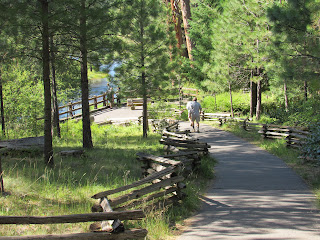
 As I walked down the path to the, "Head of the Metolius," I just took a couple of snaps. The Metolius, as described here, is the outpouring of a giant spring the feeds the river. The pictures show the water coming straight from a rock outcropping. For me, it seems a lot of water to continuously pour from the ground.


 This is actually the rocky outcropping from which pours the Metolius River.
 This is a peaceful setting at the Riverside campground near the Metolius River.
 Here's the view from the tent as I woke. (Am I getting a little desperate for subject material?)
 Does all of this really fit on the bike? I ask myself that most every morning. But it all fits...every time.
 I'm so grateful for my friend's suggestion that I visit this site. Camping among the Ponderosa pines is spectacular. I love their sweet smell.
 The selfie...a happy camper indeed!